
The Myth Of More Gear: Why Less Can Be More

Weight Compounds Across Distance
You think more gear means more safety. That’s not the mechanism at work—it’s actually fear disguised as preparedness. In physics, carrying capacity has a hard limit. Every extra pound compounds over miles, degrading your decision-making speed, physical reserve, and ability to respond to actual hazards.
Most beginners pack redundant items: two headlamps, multiple first aid kits, backup layers they’ll never wear. The weight tax is real. A ten-pound pack difference means slower movement, earlier fatigue, reduced stability on technical terrain. Fatigue kills more hikers than gear failures do. Your pack should enable movement, not restrict it.
The Signal And The Noise

Common advice tells you to “bring everything just in case.” That’s lazy thinking dressed up as caution. The real distinction isn’t between “essential” and “nice to have”—it’s between gear that solves a specific problem on your planned route and gear that addresses fantasy scenarios. A GPS device is essential for navigation on unmarked terrain. A backup GPS is noise. A water filter is essential where water sources are uncertain. A backup filter adds no margin.
The protocol: before each trip, list the actual hazards of your specific route and conditions. Then list only the gear that directly mitigates those hazards. Everything else stays home. This forces you to know your terrain and your limits instead of outsourcing safety to volume.

The Cognitive Load Protocol: Decision Making Under Duress
Mental Rehearsal Before You Leave
You want this section because you’re afraid you’ll freeze when something actually goes wrong. Most hiking advice skips this entirely, treating safety like a checklist instead of a skill. The mechanism is called mental simulation in cognitive psychology, and it works by pre-loading your decision pathways before stress shuts them down. Your brain under duress defaults to pattern recognition. If you’ve already run the scenario in your head, your body treats it as familiar, not novel.
Spend 20 minutes before any hike running through failure states. Not generic “what ifs”—specific scenarios tied to that trail. Weather turns, someone twists an ankle at mile three, you lose the group. Walk through your exact response each time, including what you say and where you move. This isn’t visualization nonsense. You’re building neural pathways that bypass panic. The clearer your mental model, the faster you execute when adrenaline floods your system.
Action Hierarchy Over Instinct
The common advice says “stay calm,” which is useless because panic isn’t a choice you make. What actually works is pre-deciding your action sequence so your brain never faces that decision under stress. Military doctrine calls this the OODA loop: Observe, Orient, Decide, Act. In hiking, this means knowing your priority order before the emergency happens, not during it.
Your action hierarchy on the trail is simple and unchanging: stop moving, assess the person, assess the environment, communicate the situation, execute the appropriate response. Write this down and memorize it. When crisis hits, you don’t think. You execute the sequence you’ve already decided. The person who acts from pre-established protocol survives better than the person who tries to think clearly while cortisol is spiking through their bloodstream.
Terrain As Teacher: Reading The Landscape Like A Pro
What Your Feet Actually Tell You
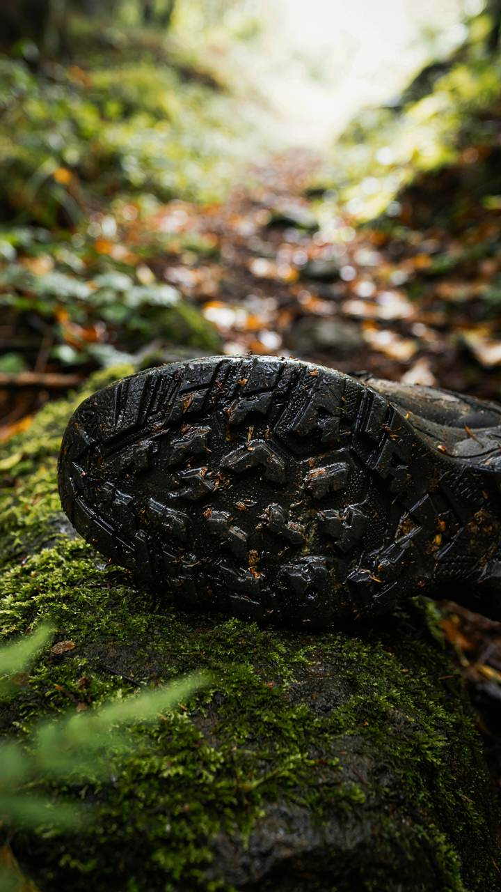
You want to feel competent before you step onto the trail. The mechanism most people miss: terrain speaks through texture and angle, not through Instagram photos or park websites. Borrow from geology—think of slope aspect as a terrain’s exposure to elements. South-facing slopes dry faster. North-facing slopes hold moisture longer and stay treacherous after rain. Your boot grip depends on reading this, not on guessing.
The ground beneath you changes behavior based on time of day, weather history, and season. A slope that’s solid at dawn becomes a skating rink by afternoon as sun melts subsurface ice. Loose rock on a 30-degree incline rolls differently than the same rock on a 15-degree pitch. The angle matters because gravity’s work compounds. Most beginners scan terrain once and assume consistency. Terrain inconsistency is where accidents happen. Your job is to notice the shifts and adjust your footing cadence and weight distribution before your boot finds the problem.
How Trails Fail And Why
Erosion isn’t random destruction—it follows water. Understanding where water moves on a trail tells you where the path will degrade fastest. High-traffic areas compress soil, which reduces water infiltration and channels runoff into ruts. These ruts become streams during rain. The trail doesn’t fail at its widest point. It fails where it’s been beaten into a channel.
Old erosion patterns predict fresh hazards. When you see a deep rut carved into the trail, the outer edge is undercut—the soil beneath the tread hangs unsupported. A boot placed on that edge breaks through. When you see exposed root systems, water has stripped away topsoil, which means the trail is actively retreating upslope. Avoid walking on exposed roots in wet conditions because they’re slick and unstable. Before you start moving, identify which sections show active erosion and plan your foot placement to bypass the degraded zones entirely.
The Human Factor: Beyond The Hiking Checklist
Who Actually Makes The Call
You want this section because you’re hoping someone else will take responsibility if things go wrong. They won’t. Group dynamics operate like a system of diffused accountability: the larger the group, the weaker each individual’s sense of obligation to act. This is social psychology, and it kills people on trails.
The turning point happens when someone notices a problem but assumes someone else noticed it first. One person feels tired but stays quiet because the group seems committed. Another sees weather deteriorating but doesn’t want to seem weak or paranoid. Nobody vetoes the plan. You summit the ridge at dusk instead of turning back at 2 PM. The mechanism is simple: establish one person as the final call maker before the hike starts. Not by committee vote. One person decides when to turn back, reduce pace, or stop early. Everyone agrees to this structure in advance. That person changes on different hikes, but the structure never does.
Fitness Reality Versus Trail Math
The common advice is to “know your limits.” That’s useless. What matters is the gap between what the trail demands and what you can sustain for eight hours. This isn’t about ego. It’s about energy expenditure and terrain matching.
A three-mile hike at sea level on flat ground burns roughly 200-300 calories per hour for an average adult. The same three miles at 10,000 feet elevation with 2,000 feet of vertical gain burns 500-700 calories per hour and demands aerobic capacity that flat training doesn’t build. Most beginners underestimate vertical gain by 40 percent and overestimate their sustained pace by 30 percent. Calculate your actual pace on your hardest recent hike, then find trails that demand less than that. The safety margin isn’t about feeling confident. It’s about having energy to respond when something goes wrong.
Emergency Preparedness: Applying Military Strategy
Observe Orient Decide Act On The Trail
You want to feel prepared so you don’t look stupid if something goes wrong. The mechanism that separates hikers who handle emergencies from those who panic is the OODA Loop, borrowed from military combat theory. Observe the conditions changing. Orient yourself to what that change means. Decide on action. Act. Most hikers skip straight to panic because they never trained the loop to run fast.
The gap between observation and action is where people die. A twisted ankle isn’t the kill. The delay between noticing the ankle won’t bear weight and deciding to call for help is. You compress that loop by running it before the emergency. On practice hikes, narrate what you observe about terrain difficulty, weather shifts, and your group’s pace. Force yourself to orient and decide before you need to. The muscle memory of that cycle saves time when adrenaline floods your brain and rational thought gets expensive.
War Plans Meet Wilderness Uncertainty
Contingency planning isn’t making a list of bad things and hoping they don’t happen. It’s thinking like a general: you map routes, identify choke points where help becomes impossible to reach, and pre-stage resources at those points. Every hike needs a baseline plan and three branches for when that plan breaks.
Document your route on paper and leave a copy with someone not on the hike. Include turnaround times, where cell service drops, and the nearest trailhead you can reach from any point. If your group doesn’t reach the next checkpoint by the deadline, the person holding your plan calls search and rescue with exact coordinates. That’s not paranoia. That’s the difference between a rescue that finds you in two hours versus twenty. Pre-decide your abort triggers before the hike starts: weather deterioration, injury threshold, darkness arrival time. Write them down. Emotion won’t overrule ink.
Weather Intelligence: Outsmarting The Elements
The Forecast Trap And What Actually Matters
You want the forecast to tell you the hike is safe. That’s the real motive here. It won’t. A forecast is a probability model, not a promise. Borrow from meteorology: the concept of “resolution” means the smallest detail a model can actually predict. Most publicly available forecasts have terrible resolution at the local scale where you hike. A 10-day forecast for your trailhead town tells you almost nothing about conditions 3,000 feet higher on the ridge where you’ll actually be.
The mechanism is simple. Temperature drops roughly 3.5 degrees Fahrenheit per 1,000 feet of elevation. Wind speed doubles. Precipitation that looked like rain at base elevation becomes snow at the summit. Most hikers check one forecast for the town and assume it applies to their route. It doesn’t. You need the forecast for the elevation where you’ll spend the most time, not where the weather station sits. Check the nearest mountain weather service specific to your range, not the generic weather app.
Reading The Shift Before It Happens
Weather doesn’t change instantly. It signals. The real skill isn’t predicting the unpredictable. It’s noticing the 20-minute window where conditions shift from manageable to dangerous and deciding whether you’re still in control. Wind direction change, cloud type change, pressure drop you can feel in your ears, humidity spike that makes everything feel heavier. These are observable facts happening in front of you, not forecasts.
Your job is to establish a protocol before you leave the trailhead. Document the current conditions when you start: wind direction, cloud type, visibility, temperature. Every 30 minutes on the trail, record the same data. The moment one variable shifts sharply or two move together, you evaluate. A wind shift combined with darkening clouds is not the time to summit. A pressure drop you can feel plus rising humidity means turn back now, not in five minutes.
The Unseen Threats: Avoiding Common Pitfalls

Wildlife Encounters: Avoidance, Not Confrontation
You want to believe you’ll handle a wildlife encounter well. The mechanism that gets people hurt is simple: they freeze or escalate instead of preventing the encounter entirely. Wildlife doesn’t want contact. It wants resources and space. Apply basic game theory here: your role is to remove yourself as a variable in the animal’s decision-making, not to “stand your ground” or test its tolerance.
- Make noise before you arrive: Most wildlife leaves when it hears humans coming. Talk, use a whistle, or clap at regular intervals on trails. Silent hiking increases surprise encounters dramatically.
- Store food in bear canisters or hung lines: Animals return to food sources. Leaving scraps or unsecured meals teaches wildlife to expect human food, raising conflict risk for future hikers and yourself.
- Never approach young animals: A mother is defending resources and territory. Distance yourself immediately if you see offspring. Assume the parent is nearby and watching.
- Know the specific threats in your region: Grizzly country requires different protocols than cougar country or snake-prone terrain. Research what animals live where you’re going and their seasonal behavior patterns.
- Carry bear spray only in bear country and know how to use it: Spray is not a weapon. It’s a last-resort deterrent. Untrained use wastes the canister or makes situations worse. Practice deployment before the trip.
The goal is zero encounters. You do this by hiking during daylight, staying on marked trails, and leaving before dusk. If you see an animal, back away slowly without running. Running triggers predatory responses. Most wildlife incidents happen because hikers either surprised an animal or got between a mother and offspring.
Water Sources: Purification And Hydration
Most hikers think dehydration is the threat. It’s not. The real threat is drinking untreated water and getting sick days or weeks after the hike, when you can’t connect it to that alpine stream. Giardia and cryptosporidium don’t cause symptoms immediately. You get home, feel fine for a week, then become incapacitated for months.
Bring a filtration system or chemical treatment. Boiling works but requires fuel and time most day hikers don’t plan for. A lightweight pump filter or squeeze filter removes bacteria and protozoa. Tablets work but taste bad and take thirty minutes to an hour. Ultraviolet pens work but don’t protect water stored in bottles for later. Pick one method and test it before the hike so you know how long it takes and whether you’ll actually use it under fatigue. Drink before you feel thirsty. Thirst means you’re already mildly dehydrated and your decision-making starts degrading. Carry at least two liters of capacity for a day hike in temperate conditions, more in heat or at altitude. If you filter or treat as you go, one liter capacity works if you refill at every water source. The mechanism here is simple: you either prevent contamination or you get sick weeks later and never attribute it to the hike.
Navigation Beyond GPS: The Analog Advantage

Map And Compass Mastery
You want this section because GPS failures expose you, and you’re betting your life won’t be the exception. The mechanism is simple: GPS is a receiver dependent on satellite geometry and battery state. It fails predictably when you need it most—canyon bottoms, dense forest, dead battery. Map and compass work through physics that doesn’t require external infrastructure. You orient the map by aligning its grid lines to magnetic north using the compass baseplate. This takes sixty seconds and works in any weather, any terrain, any time.
Competence here means three skills practiced before the trail. First, identify your location on a map using terrain association—matching visible ridges and valleys to contour lines. Second, set the compass to your destination bearing, then rotate yourself until the orienting lines align with map grid north. Third, walk the bearing while checking terrain features every few minutes to confirm you’re on route. Most hikers skip this because it feels slower than a screen. It’s not. A map never runs out of battery.
Reading Natural Navigational Cues
The common advice here is garbage: follow the sun, count trees, trust your gut. That’s how people die on familiar trails. Real navigation uses biology and geology together. Sun position tells you direction only if you know the time and your latitude. Slope aspect—which direction a hillside faces—combines with vegetation patterns to confirm your location. North-facing slopes hold snow longer and grow denser conifer stands. South-facing slopes dry faster and support different plant species. Water always flows downhill toward rivers, which means if you’re lost in a drainage system, following water downstream eventually reaches human infrastructure.
Your actual protocol: identify one terrain feature you can verify on the map, then locate a second feature that confirms it. A saddle between two peaks, a ridgeline running east-west, a river bend visible from above. Never rely on a single clue. The moment you spot two matching features on the map and on the ground, you own your location. This is orientation, not luck, and it requires you to stop moving and think. When GPS dies and clouds cover the sky, this habit is the difference between reaching camp and spending the night in the wrong place.
The Only Real Danger Is Your Illusion Of Control

Most hikers obsess over gear and checklists because they feel safer pretending they’ve eliminated risk. They haven’t. You control preparation, not outcomes. Weather changes. Bodies fail. Accidents happen. Your real edge is mental flexibility, not equipment. Stop planning the perfect hike and start building the reflexes to handle whatever shows up. Pick a trail today. Walk it. Notice what you missed in your planning. That’s where your actual safety lives.