
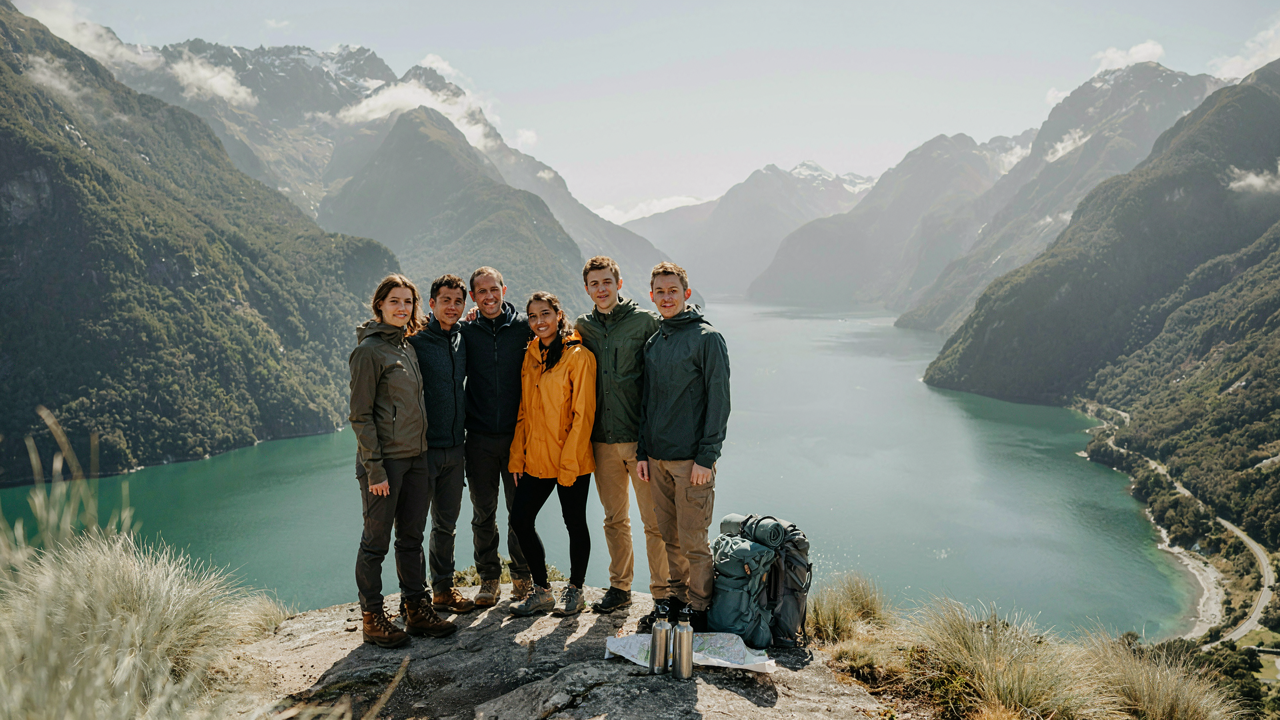
Fiordland National Park: Beyond The Brochure Filters

Weather Doesn’t Care About Your Plans
You want to believe you can time it right. That’s the real issue here. The mechanism is simple: Fiordland sits on the west coast of New Zealand’s South Island, exposed to Southern Ocean systems that generate five to seven day weather cycles you cannot predict with accuracy beyond 48 hours. The park receives between 200 and 400 centimeters of rain annually depending on location. Milford Sound gets hammered hardest. This isn’t seasonal weather. This is the baseline.
The common advice says check the forecast. That’s incomplete. Fiordland’s terrain accelerates weather systems and creates localized conditions that regional forecasts miss entirely. Wind funnels through valleys and reverses direction without warning. Precipitation intensity changes within single valley systems. You don’t plan around the forecast here. You plan around the certainty that conditions will shift, and you build flexibility into your route and timeline to absorb that shift without failure.
Stone Shaped By Indifference

Geology operates on deep time, a framework where human intention ranks as noise. Fiordland’s fjords carved over multiple glaciation cycles, the most recent ending around 18,000 years ago. The valleys dropped vertically as glaciers scraped downward, then seawater filled the voids. What you see now is a landscape built by processes that took no account of your visit or your ambitions. The rock faces and ridges you traverse are still actively shedding material through weathering and erosion.
Understanding this changes your navigation strategy. Trails here don’t exist because the terrain is stable or predictable. They exist because humans established them despite constant geological reshaping. Rockfall happens. Stream crossings shift annually. The Rees-Dart Track and Milford Track both experience trail damage and rerouting cycles that remake sections every few years. You don’t hike Fiordland assuming the terrain will cooperate. You move through it with the assumption that you’re traversing an actively evolving system, which means verifying current conditions with local DOC rangers before departure.

The Milford Track New Zealand Trail: Overhyped Or Overlooked?
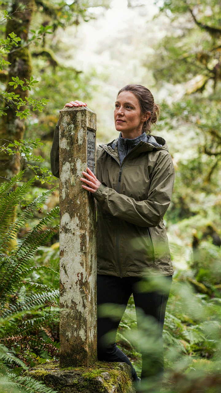
The Machinery Behind The Hype
You want permission to do what everyone else does and call it an achievement. That’s the real mechanism at work here. The Milford Track earned “Great Walk” status in 1973, and that designation became a self-perpetuating engine. Tourism operators branded it. Media amplified it. Now 14,000 hikers annually queue for a track that hasn’t meaningfully changed in fifty years, treating completion like a passport stamp rather than a hiking experience.
The scarcity model drives everything. DOC limits daily walkers to about 90 on the independent track and hundreds more on guided trips, creating artificial demand. You can’t just walk when you want. You book months ahead. That friction converts casual interest into committed intent, which converts into prestige once you finish. The hype isn’t accidental. It’s structural.
What The Guidebooks Won’t Tell You
Most hiking guides omit the obvious fact: the Milford Track is logistically optimized, not scenically unique. You follow marked trails, stay in huts with bunks and bathrooms, and eat communal meals. The infrastructure removes most variables. This appeals to people who want the story more than the solitude, but it also means you’re experiencing a managed product, not wilderness. The real Fiordland hiking lives elsewhere.
The track’s famous day-hikes exist in a compressed schedule that flattens engagement. Sutherland Falls impresses photographically but rewards no patience. The Clinton River walk feels obligatory. What most tourists miss is that you’re not discovering anything—you’re consuming a predetermined route alongside hundreds of other people doing the same thing. If you want Fiordland’s mechanism of isolation and self-reliance to actually function, you navigate off these rails.
The Fiordland Protocol: Self Reliance In A Brutal Landscape

Pack Weight Forces Better Decisions
You want to feel prepared without admitting you’re terrified of looking unprepared. The mechanism is this: weight is a constraint that eliminates false choices. In systems design, constraints force optimization. Fiordland imposes one hard constraint—terrain that punishes extra mass—so you stop pretending you need backup gear for backup scenarios.
Every item earns its spot or gets cut. A lighter pack means faster movement, which means you exit danger faster. You cover the Milford Track’s 53 kilometers in four days because the terrain demands speed. Extra weight doesn’t add safety; it creates new problems: fatigue, slower stream crossings, reduced reaction time on rock scrambles.
- Shelter layer only: A lightweight rain shell and merino wool base layer replace redundant jackets. Fiordland weather changes in minutes, not hours—you react, not prepare for contingencies.
- Single cooking pot: One 1.5-liter titanium pot handles both fuel efficiency and weight. Fiordland water sources are abundant, making bulk capacity unnecessary.
- Minimal food strategy: Calorie density matters more than variety. Bring high-fat foods like nuts and jerky. Less weight per calorie burned equals less body strain over four to five days.
- Ultralight pack frame: A 35-45 liter pack distributes load on your hips, not shoulders. Shoulder pain compounds decision-making errors on exposed ridges.
- Single multitool: One quality blade handles rope, gear repair, and food prep. Redundant tools waste grams without adding function.
The protocol: total base weight under 6 kilograms before food and water. This number isn’t arbitrary. It matches the weight threshold where fatigue stops degrading decision quality on Fiordland’s technical terrain. Weigh your pack. If it exceeds this, something isn’t earning its place.
Competency Replaces Gear Quantity
Emergency kits don’t fail because they lack items—they fail because the person carrying them hasn’t rehearsed the scenario. The distinction matters in Fiordland’s isolation. You’re often 12+ hours from any exit. A first aid kit is useless if you can’t identify a twisted ankle from a fracture or stop panic bleeding before shock sets in.
Most hikers buy redundant gear hoping it compensates for skill gaps. A backup GPS, a satellite communicator, extra cordage. These items add weight without increasing actual resilience. What increases resilience is knowing how to navigate without GPS, how to improvise shelter from a tarp and knowledge of wind direction, how to cross rivers without panicking. Fiordland demands you develop river crossing technique before you need it. Practice stream step placement on day trips. Understand how water temperature affects grip strength. Know the mechanics of how to move in groups through current.
The real emergency kit is your nervous system’s calibration. Before Fiordland, complete at least one solo overnight hike on New Zealand terrain—the Routeburn Track or Kepler Circuit work. This trains pattern recognition for weather shifts, teaches you to read terrain moisture for stability, shows you how exhaustion affects judgment. On Milford, Routeburn, or Rees-Dart, you’ll make 50+ micro-decisions per day. Each one relies on whether you’ve seen the outcome of that choice before. When the weather turns and visibility drops to 20 meters on a ridge, the backup whistle doesn’t protect you—your ability to move deliberately through white-out does. Train accordingly before arrival.
New Zealand Mountain Hike: The Psychological Calculus Of Ascent

How Routes Become Strategic Decisions
You’re reading this because you want permission to turn back without feeling weak. The real mechanism is route assessment through game theory—treating the hike as a series of decision nodes where information changes your available options. In Fiordland, routes like the Routeburn Track or Milford Track present layered terrain. You don’t evaluate the whole hike upfront. You assess segments. Each pass, each ridgeline, each stream crossing becomes a node where you calculate: continue or descend based on fresh data about weather, fatigue state, and daylight remaining.
Most hikers treat route choice as binary commitment. Wrong. Game theory reveals the actual structure. The Nash equilibrium for Fiordland hiking isn’t pushing to the summit. It’s maintaining the option to retreat at every major waypoint. Poor weather moves information asymmetrically. A clear morning at the Key Summit trailhead looks different at 2 PM when clouds roll across the Darran Mountains. Your best move shifts. Build routes with descent options, not just ascent options. The psychological win isn’t reaching the top. It’s making rational choices with incomplete information and sleeping well after.
Recognizing When Fatigue Becomes Liability
Cognitive load doesn’t drop when your legs burn. It rises. Exhaustion narrows the decision space precisely when you need it widest. On steep sections like those ascending to the Divide on the Milford Track, your brain offloads non-essential processes. Navigation accuracy drops. Risk assessment becomes emotional rather than tactical. You stop seeing the fall line clearly. You stop noticing the loose schist underfoot.
Pre-hike preparation dampens this. Memorize landmarks before fatigue hits. Mark GPS waypoints at every turn, not just at endpoints. Know your bailout spots. When exhaustion arrives, your job isn’t to think harder. It’s to follow a system you built when fresh. The specific protocol: stop every ninety minutes, sit down, eat something with salt and carbs, review your next segment on the map while sitting. This resets cognitive load. It keeps decision-making rational instead of reactive. Your legs recover slower than your judgment, so protect the judgment first.
New Zealand Forest Hiking Trails: The Green Labyrinth Unveiled

What The Forest Is Actually Telling You
You want to feel competent out there, like you read the forest and made smart decisions. Here’s what actually matters: Fiordland’s forest operates like an organism’s immune system, and you’re a foreign body moving through it. The beech, rimu, and podocarp trees don’t exist to guide you. They exist to compete for light and water. The canopy density, the undergrowth structure, the moss coverage on fallen logs—these aren’t aesthetic details. They’re data points about drainage, slope angle, and soil stability. Read them wrong and your route-finding fails.
Fiordland’s native forest evolved without large terrestrial predators, so plants grew dense and low, with minimal open understory. This density means sight lines disappear fast. Trails vanish under moss and leaf litter within weeks of poor maintenance. The forest doesn’t resist hikers—it erases them. Tree roots anchor into shallow soil over bedrock, creating ankle-breaking hazards under that moss carpet. Study the specific forest type before you walk. Rimu and kamahi forests on lower slopes stay wetter longer. Beech forests on higher ridges drain faster but expose you to wind and exposure.
Navigation Without Instruments
The common advice here is useless: “follow the stream” or “use landmarks.” That’s how people get lost. Fiordland’s terrain has multiple parallel streams that merge unpredictably, and landmarks look identical under cloud. You need a protocol. Physical map and compass work in Fiordland because the magnetic declination stays stable and the topography is extreme enough that contour lines tell you terrain story. GPS fails in deep valleys where satellite signal bounces off cliff faces. Electronic devices drain fast in cold, wet conditions.
Learn to cross-reference your map location using ridge lines, valley shapes, and the specific angle of descent. Mark your position every 500 meters by physically writing it down. This isn’t paranoia—it’s how experienced Fiordland guides operate. Carry a waterproof map case and keep your compass accessible without removing your pack. The moment you stop to fish your compass from a backpack pocket in rain is the moment you lose precise orientation. Train yourself to read contours during trip planning, not during the hike.
Milford Sound: A Moment, Not A Destination

The Cruise Ship Problem Isn’t The Cruise Ships
You want to believe you’ll beat the system and see Milford Sound “the right way.” That’s the real motive here—status anxiety dressed up as authenticity. The mechanism is simple: Milford Sound operates under a bottleneck economy. One fjord. One road in. Thousands of people daily during peak season. You cannot escape the crowds through timing tricks or obscure trails because the fjord itself is the attraction, not a route to somewhere else.
The cruise ships aren’t your enemy. They’re a symptom of a fixed resource. Most hikers arrive mid-morning after the Milford Road drive, creating a secondary wave that overlaps with boat departures. The real play isn’t avoiding people—it’s accepting their presence and moving through the space differently. Early morning hikes on the Milford Track itself, or day walks like Key Summit or Chine Creek, run perpendicular to the cruise schedule. You’re not dodging crowds; you’re operating on a different timeline entirely.
Solitude Lives In The Margins
The consensus advice is wrong: you don’t find solitude at Milford Sound by waking up early or visiting off-season. You find it by understanding that Milford Sound operates as a compression point, and compression creates edges. The boat traffic concentrates between 10 AM and 3 PM. The Milford Track itself has a strict daily hiker limit and booking system—roughly 90 people per day spread across a 33-kilometer walk. This scarcity is your actual lever.
Walk the fjord’s water line at dawn or dusk when the sound’s character shifts entirely. The light becomes directional instead of ambient. The echoes of waterfalls change frequency. Fewer people means the environment stops performing and starts existing. Book the Milford Track off-peak if budget allows—October or April see half the summer volume. If that’s impossible, take a half-day walk like Darran Mountains or Gertrude Valley before or after the main tourist wave. The key move is treating Milford Sound as a 12-hour window to coordinate around, not a single destination moment.
Map Of Fiordland National Park: Your Brain Is The Best GPS

How To Read A Topographic Map Without Losing Your Mind
You want the map to do the thinking for you. That’s the real reason you’re reading this. But topographic maps don’t reduce complexity, they reveal it. Learning to read them means accepting that the terrain is far more detailed than your mental model of it.
Contour lines on a Fiordland topo map show elevation change. Each line represents a fixed vertical interval, usually 20 meters on 1:50,000 scale maps. Tightly spaced lines mean steep terrain. Wide spacing means gentle slopes. The Darran Mountains and Kepler Range dominate Fiordland’s topography. Studying how lines cluster around valleys versus ridges teaches you to see slope angle before you feel it in your legs.
A topographic map becomes useful only when you connect three things: contour spacing to steepness, elevation numbers to cumulative vertical gain, and distance on the map to actual walking time. Most hikers skip the third step entirely. They estimate time from flat distance, not from terrain difficulty. On Fiordland tracks like the Milford or Routeburn, a kilometer through dense beech forest or across boulder fields takes far longer than a kilometer on open tussock. The map tells you what kind of terrain you’re crossing. Your job is to translate that into real hours.
Navigation By Terrain Recognition, Not Landmarks
Terrain reading is the opposite of landmark hunting, and Fiordland punishes landmark thinking. Weather rolls in fast. Visibility dies. You can’t navigate by “the big rock shaped like a hat” when cloud obscures everything beyond fifty meters. You navigate by understanding the slope beneath your feet.
The mechanism is proprioceptive mapping. Your body collects data about gradient, ground texture, and slope direction as you move. Combine that with contour awareness from your map study, and you know where you are without seeing anything. On a Fiordland descent, you learn the angle of a thirty-degree slope versus a twenty-degree slope. You feel scree underfoot versus tussock. You notice when the slope rolls left instead of straight down. These sensations match the contour patterns you memorized. Use them as your primary navigation tool, not as backup.
When you hike Fiordland, stop frequently and locate yourself on the map by reading terrain, not by searching for marked features. Identify which valley you’re in. Notice whether you’re ascending, descending, or traversing. Check the contour spacing around your position. This habit builds the mental model that keeps you oriented when conditions deteriorate. Before you rely on a map in fog or thick forest, practice this method in clear weather repeatedly.
Beyond The Milford Track: Untamed Hiking Fiordland New Zealand

Doubtful Sound’s Real Obstacles
You want to do Doubtful Sound because nobody talks about it, which means you think it’s easier than Milford. It isn’t. The real mechanism at work here is scale. Doubtful Sound operates on archipelago logic: the terrain sprawls across multiple water passages and forested valleys, which means navigation decisions compound. One wrong turn doesn’t cost you an hour. It costs you a full day retracing ground or bushwhacking through native beech forest that fights back harder than it looks.
The standard advice says Doubtful Sound is “less crowded.” True but useless. What matters is the Wilmot Pass crossing itself. At 793 meters, it sits lower than Milford’s Harris Saddle, but the track deteriorates faster in wet conditions because the trail bed is narrower and drainage fails quickly. Beech roots create a ladder effect on descent that shreds boots and knees. Book with a registered guide operator if weather looks unstable. They read the pass conditions daily and know which alternate routes work when the main track floods.
Finding Routes Nobody Maps
The temptation is to search for “secret tracks” online and follow GPS coordinates. This produces dead ends and lost time. What actually works is understanding Fiordland’s terrain structure. The DOC maintains about 40 established trails. Everything beyond that is backcountry travel requiring navigation skills, not trail-following. Map reading beats guidebooks here. Contour lines show you where ridgelines form natural corridors between valleys, where water runoff creates passable gullies, and where dense forest makes travel functionally impossible.
Start with one-day explorations from established trailheads to build pattern recognition. Notice how beech forest density shifts near ridgelines. Watch how stream positions indicate terrain stability. After three or four runs, you stop looking for “hidden trails” and start reading the landscape itself. The real protocol is this: identify a summit or pass on a 1:50,000 map, plot a realistic route using contours and vegetation markers, inform DOC of your intended route, carry navigation gear you’ve actually used before, and leave your detailed itinerary with someone. The mechanism isn’t finding trails. It’s building competence to evaluate ground nobody’s marked yet.
The Real Price Of Admission: Mental Fortitude

Discomfort Is The Actual Trail
You’re reading this section because you want proof that you’ll survive it. You won’t find that proof here. The mechanism is simple: Fiordland breaks you down through sustained discomfort, not single catastrophic moments. Use military terminology—what strategists call “attrition”—and you’re experiencing exactly that. Rain doesn’t stop for six hours straight. Your legs burn on mile eight of a fourteen-mile day. Mud sucks your boot off. The discomfort compounds because your body can’t fully recover between days.
The common advice says “embrace the struggle” or “push through.” That’s incomplete. Real resilience isn’t about ignoring discomfort—it’s about decoupling discomfort from the decision to quit. Fiordland teaches this fast because the environment doesn’t negotiate. You feel miserable and keep moving anyway. That’s the skill. Not stoicism. Not toughness. Just the mechanical ability to act despite what your body is screaming at you. This compounds over multiple days into something that changes how you see your own limits.
Suffering Reveals What Stays True
Most advice about learning through hardship is sentimental garbage. Here’s what actually happens: when you’re exhausted, hungry, and wet for hours, your brain stops running the usual background programs. The narratives you tell yourself about who you are, what matters, what’s difficult—they collapse. You stop posturing. Fiordland accelerates this because the environment is indifferent to your self-image.
On day four of the Milford Track or Routeburn Track, you find out what you actually value and what you were just performing. Relationships you thought mattered reveal themselves as obligations. Goals you thought were important show themselves as ego. The clarity isn’t metaphorical—it’s neurological. Your prefrontal cortex, exhausted, stops running interference on your deeper patterns. Write down three insights from that fourth day. Then check them against your life three months later. They’ll still be true.
Your Greatest Obstacle Isn’t The Terrain; It’s Your Expectation Of Comfort

Fiordland doesn’t care about your hot shower schedule or your sleep quality. The real test isn’t summiting a peak or crossing a pass. It’s abandoning the fantasy that nature owes you convenience. Most hikers fail before they start because they pack comfort instead of competence. Stop scrolling through gear reviews today and hike one local trail without your phone. The mountains don’t judge weakness. They only expose it.